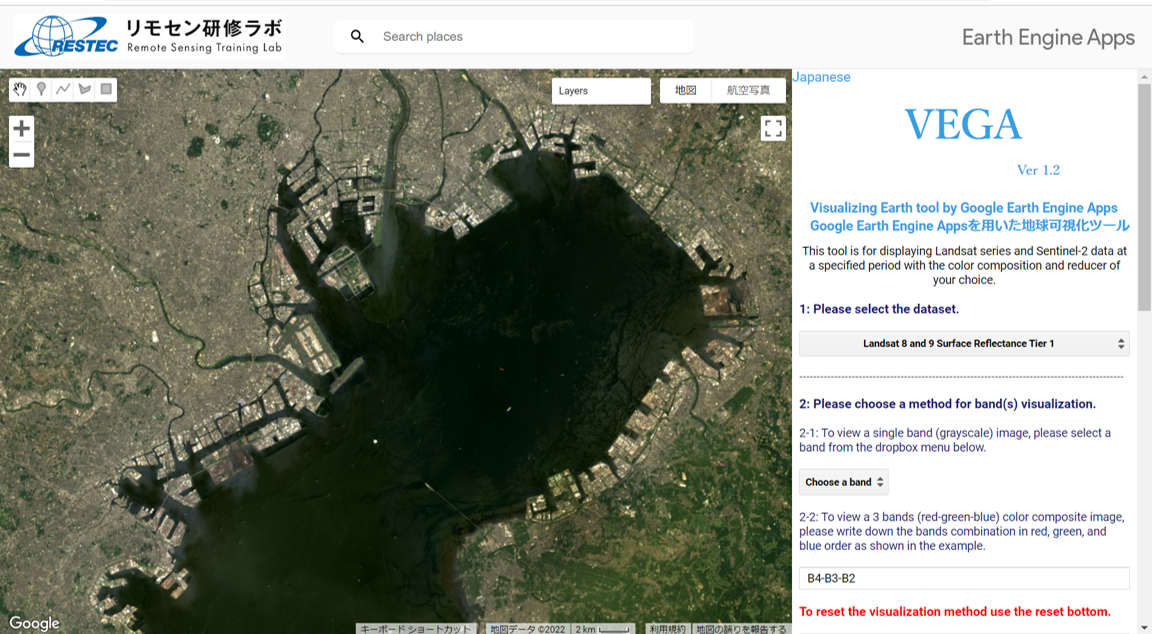
 Screen shot of VEGA. Users can visualize satellite data with the control panel on right hand side. This image shows Tokyo Bay taken by Landsat in 2022.
RESTEC has released a new version (version 1.2) of VEGA*1, a web-based application to browse and visualize Landsat and Sentinel-2 data. Version 1.2 includes the data from past Landsat satellites (4, 5, and 7) and Landsat-9 launched in 2021, in addition to the existing Landsat-8 and Sentinel-2. This improvement makes it possible to visualize historical data from 1982. In addition, users can access Landsat-8 and 9 data which are observed once every eight days from October 2021 onward. Furthermore, while the previous version included Surface Reflectance (SR) of Landsat-8 and Top-Of-Atmosphere (TOA) of Sentinel-2, version 1.2 includes SR and TOA*2 for both Landsat series and Sentinel-2.
The datasets and their observation periods available on VEGA are as follows.
- Landsat-4
・ SR: August 1982 – June 1993
・ TOA: August 1982 – December 1993
- Landsat-5
・ SR: March 1984 – May 2012
・ TOA: April 1984 – November 2011
- Landsat-7
・ SR: May 1999 – April 2022
・ TOA: June 1999 – April 2022
- Landsat-8
・ SR and TOA: April 2013 – Present
・ Raw data (for training purposes): March 2013 – Present
- Landsat-9
・ SR and TOA: October 2021 – Present
- Sentinel-2
・ SR: March 2017 – Present
・ TOA: June 2015 – Present
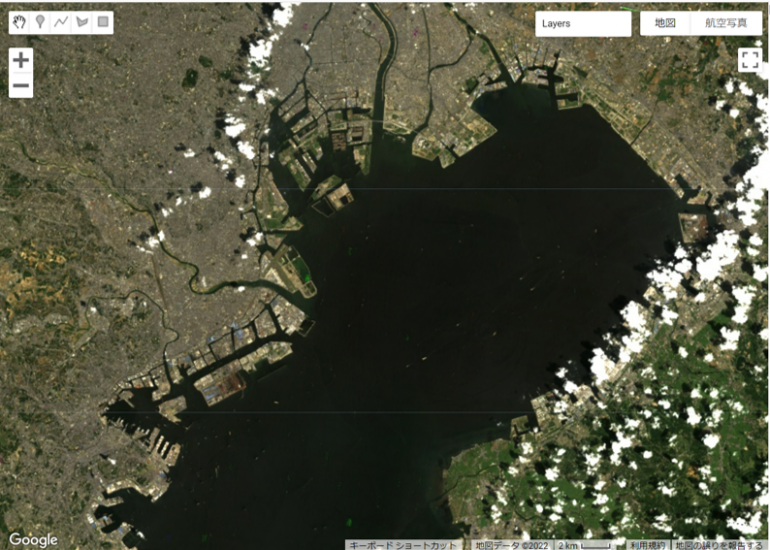 Users can visualize historical data from1982. This image shows Tokyo Bay taken by Landsat in 1984.
There is no change in the basic operation. Users of Google Earth Engine (GEE) usually are required to write JavaScript code to visualize any dataset, but VEGA doesn’t require any JavaScript knowledge. You can select different options or input on the control panel. Anybody who has an interest in remote sensing and visualizing satellite data can use VEGA without user registration or signing up.
・Try using VEGA
・User’s Manual(latest version)
・Past announcements
Google and the Google logo are registered trademarks of Google LLC, used with permission.
*1 VEGA
Visualizing Earth tool by Google Earth Engine Apps
*2 Top-Of-Atmosphere Reflectance and Surface Reflectance
Top-Of-Atmosphere (TOA) Reflectance is the data of sunlight reflection from the upper atmosphere, and Surface Reflectance (SR) is the data of reflection from the ground surface after correcting for the atmospheric effect. Since the effect of the atmosphere was removed from SR, it is easier to compare observation data from different periods and different satellites.
Terms of Use
Revision Date: 30th January 2024
RESTEC grants users the right to use the ‘Visualizing Earth tool by Google Earth Engine Apps (VEGA)’ under the following conditions. Note that users shall be deemed to have consented to the content of the Terms of Use upon their use of VEGA.
- The copyright and other intellectual property rights of VEGA belong to RESTEC.
- Users may not sell, rent or lease VEGA to any third party.
- VEGA is provided as is without warranty of any kind and RESTEC makes no warranties of any kind, either express or implied, regarding VEGA, including but not limited to its merchantability and suitability for a particular use.
- Any problems that occur with this software shall be resolved at users’ own risk and expense.
- Users shall exempt and guarantee RESTEC from damage, loss, or liability for claims made to the users by a third party related to the use of VEGA.
- Users may use VEGA screenshots in print and online articles without the RESTEC’s permission as long as they follow the Google’s guidelines and do not distort or modify them in any way.
