RESTEC has released a new version (version 2.1) of VEGA*1. Version 2.1 includes the L-band observation data taken by ALOS-2 ScanSAR.
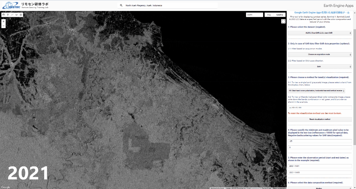 Heavy rainfall caused flooding in Aceh, Indonesia, in October 2022. These images are composition images of ALOS-2 ScanSAR observations in October 2021 before the flooding event and in October 2022 after the flooding event. The black areas, with very small backscattering values in the 2022 image show inundated areas that are significantly larger than in the 2021 image.
ALOS-2 is a SAR satellite developed and operated by the Japan Aerospace Exploration Agency (JAXA) and launched in 2014. The newly added data is obtained in ScanSAR mode which is one of the observation modes of ALOS-2, and while the spatial resolution is 25m, the observation swath is 350km, enabling observations over a wide area.
This improvement makes it possible to visualize a 8-year archive of ALOS-2 ScanSAR data from August 2014 to December 2022. Users can also visualize C-band SAR observations of Sentinel-1 as well as optical observations of Landsat-4, 5, 7, 8, 9, and Sentinel-2.
In addition, VEGA can display the latitude and longitude information of the location by clicking on the visualized image. Previously, this information was displayed in the second decimal place, but this improvement makes it possible to display it in the fifth decimal place.
There is no change in the basic operation. Google Earth Engine (GEE) users are usually required to write JavaScript code to visualize any dataset, but VEGA doesn’t require any JavaScript knowledge. You can select different options or input them on the control panel. Anybody who has an interest in remote sensing and visualizing satellite data can use VEGA without user registration or signing up.
・PALSAR-2 ScanSAR Level 2.2
・ALOS-2 PALSAR-2 ScanSAR Products
・Try using VEGA
・User's Manual

・Past announcements(version 2.0)
・Past announcements(version 1.2)
・Past announcements(version 1.0)
*1 VEGA
Earth visualization tool using Google Earth Engine Apps
Visualizing Earth tool by Google Earth Engine Apps
Terms of Use
Revision Date : 30th January 2024
RESTEC grants users the right to use the ‘Visualizing Earth tool by Google Earth Engine Apps (VEGA)’ under the following conditions. Note that users shall be deemed to have consented to the content of the Terms of Use upon their use of VEGA.
- The copyright and other intellectual property rights of VEGA belong to RESTEC.
- Users may not sell, rent or lease VEGA to any third party.
- VEGA is provided as is without warranty of any kind and RESTEC makes no warranties of any kind, either express or implied, regarding VEGA, including but not limited to its merchantability and suitability for a particular use.
- Any problems that occur with this software shall be resolved at users’ own risk and expense.
- Users shall exempt and guarantee RESTEC from damage, loss, or liability for claims made to the users by a third party related to the use of VEGA.
- Users may use VEGA screenshots in print and online articles without the RESTEC’s permission as long as they follow the Google’s guidelines and do not distort or modify them in any way.
